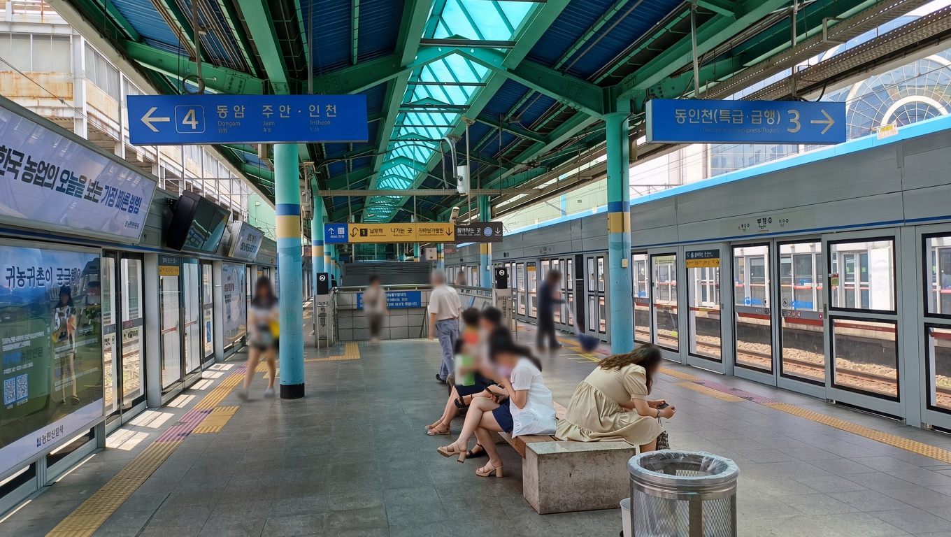
Most visitors to Incheon see exactly two things: the airport, and whatever they pass on the express train to Seoul. The city of three million people in between goes unnoticed.
Incheon Subway Line 1 is the spine of that city. It runs north to south, from a new town most Koreans have never visited to a planned international district built on reclaimed sea. Along the way it passes a Chinatown, a baseball stadium, a wetland park, an underground shopping maze, and a district where I’ve lived for years. This is a guide to what’s actually worth getting off for.
The Basics
- Operator: Incheon Transit Corporation (not Seoul Metro — different company, same fare card)
- Line colour: pale blue, representing the sea
- Stations: 33, from Geomdan Hosupark in the north to Songdo Moonlight Festival Park in the south
- Operating hours: roughly 05:30 to just past midnight
- Payment: T-money or Cashbee card, tapped in and out. Same card works on Seoul’s system, buses, and most convenience stores
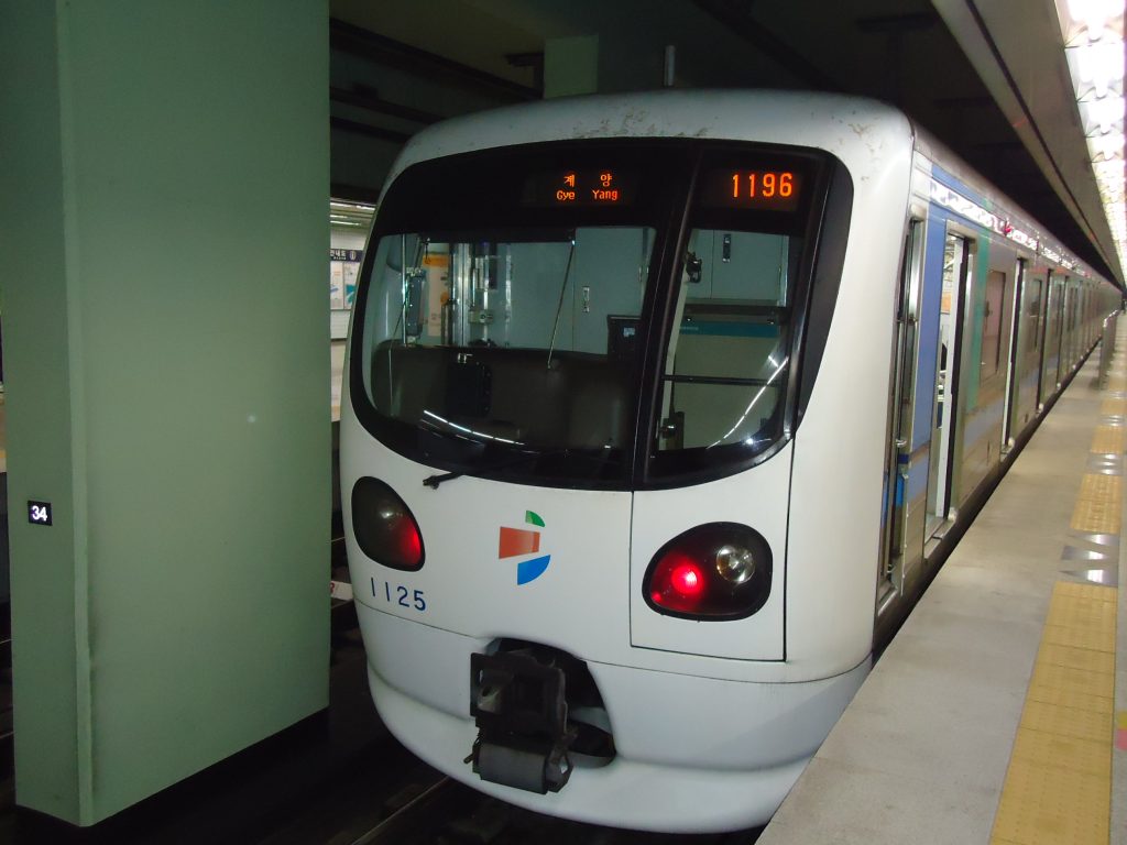
The line opened in 1999 — Incheon’s first subway, a full century after the country’s first railway ran through the city. It has been extended three times since: south into Songdo in 2009 and 2020, and north to the Geomdan new town in June 2025. That last extension added three stations and is recent enough that most English-language guides still describe a 30-station line.
Getting to the line from the airport
This trips people up constantly, so: Line 1 does not serve Incheon Airport directly. Despite the name, the airport sits on a separate island and is connected by the AREX airport railroad.
From the airport, take AREX and transfer at Gyeyang Station. That is the only interchange between the two systems. Budget around 40 minutes from Terminal 1 to Gyeyang, then however long your destination takes from there. Songdo, at the far southern end, is roughly another 45 minutes — so airport to Songdo by rail is a solid 90-minute journey. Many people take the airport limousine bus to Songdo instead, and for that particular trip the bus is genuinely faster.
Transfers Worth Knowing
| Station | Connects to | Useful for |
|---|---|---|
| Gyeyang | AREX (Airport Railroad) | The airport; also the fastest route to Seoul Station |
| Bupyeong | Seoul Subway Line 1 | Central Seoul; also Incheon’s Chinatown and Wolmido via Line 1 westbound |
| Bupyeong-gu Office | Seoul Subway Line 7 | Gangnam and southeastern Seoul without going through the centre |
| Incheon City Hall | Incheon Subway Line 2 | Crosstown east–west travel within Incheon |
| Woninjae | Suin–Bundang Line | Suwon and the southern metropolitan area |
One thing worth understanding: for reaching central Seoul, most people use Bupyeong and change to Seoul Line 1. For Seoul Station specifically, Gyeyang and AREX is faster despite looking longer on the map.
Going South: Songdo
The southern third of the line runs entirely through Songdo International Business District, built from scratch on land reclaimed from the Yellow Sea. Every station here is underground, and the stations were each given a design theme when the extension opened — the one at Central Park was built around light.
Songdo divides opinion. It is clean, spacious, and architecturally ambitious, and it can also feel eerily underpopulated in a way that unsettles some visitors. Both impressions are accurate depending on which block you stand on.
Incheon National University (인천대입구) — Central Park
The main stop for Songdo Central Park, a long landscaped strip with a seawater canal running through it. You can take a boat along the canal. There is a deer enclosure. It is pleasant, popular with families, and photographs far better than most planned-city parks manage.
Central Park (센트럴파크) — G-Tower Observatory
The single best-value thing on this entire line, and almost nobody who isn’t local knows about it. G-Tower has a public observation deck on the 33rd floor with a full view over Songdo and the sea bridge, and admission is free. Details in our guide to the G-Tower Songdo observatory.
Campus Town (캠퍼스타운)
Nearest station to Duri Ecological Park, a boardwalk running through preserved wetland — one of the few places in Songdo where the land wasn’t flattened first. Worth an hour if you want to see what this coastline looked like before the reclamation. See Duri Ecological Park.
The Middle: Where Incheon Actually Lives
This is the stretch that gets skipped, and it is the part of Incheon where most people live and work. I live in this section of the city, in Michuhol-gu, and I’d argue it’s more interesting than either end of the line.
Bupyeong (부평)
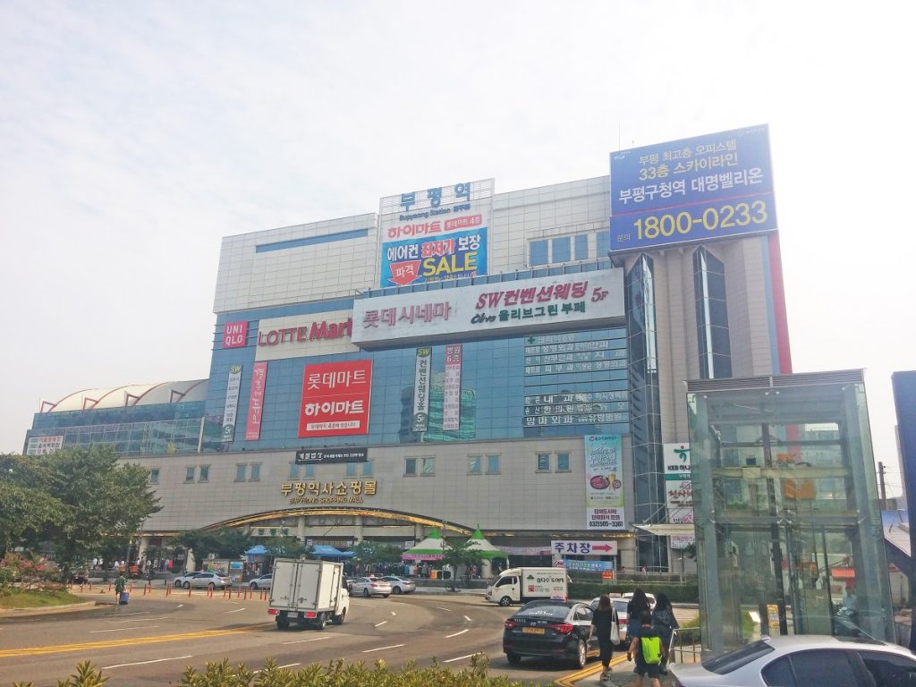
Photo: IRTC1015, public domain
The transfer at Bupyeong is the busiest on the line, and the underground arcade wrapped around it is worth leaving the platform for.
The busiest station on the line and the transfer point to Seoul Line 1. Bupyeong’s underground shopping arcade is enormous — a genuine maze of hundreds of small shops selling clothes, accessories, and cosmetics, spread across a grid that defeats first-timers routinely. Locals navigate by exit number, not by shop names, and you should too.
Incheon Bus Terminal (인천터미널)
Connected directly to a large department store and a Lotte Mart, which makes it the practical stop for anyone who needs to buy something specific rather than browse. Also where you catch intercity buses to the rest of the country.
Munhak Stadium (문학경기장)
Home of the SSG Landers baseball team. Korean baseball crowds are a genuinely distinct experience — organised chanting, team-specific songs for individual players, and permitted outside food and drink. If you are in Incheon during the season and have any interest at all, go. Tickets are inexpensive and the atmosphere does not resemble American or Japanese baseball.
Juan (주안)
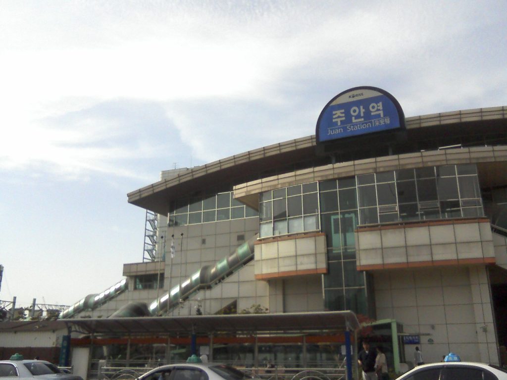
Not on Line 1 itself — it’s a Seoul Line 1 station — but it anchors the Michuhol-gu district that several stations here serve. The area around Incheon Citizens’ Park is where I’d send someone who wanted to see an ordinary Korean neighbourhood rather than a curated one. More in our piece on Juan-dong and Incheon Citizens’ Park.
Going North: Gyeyang and Geomdan
North of Bupyeong the line climbs toward Gyeyang, the airport interchange, and then continues into territory that only opened in mid-2025.
Gyeyang (계양)
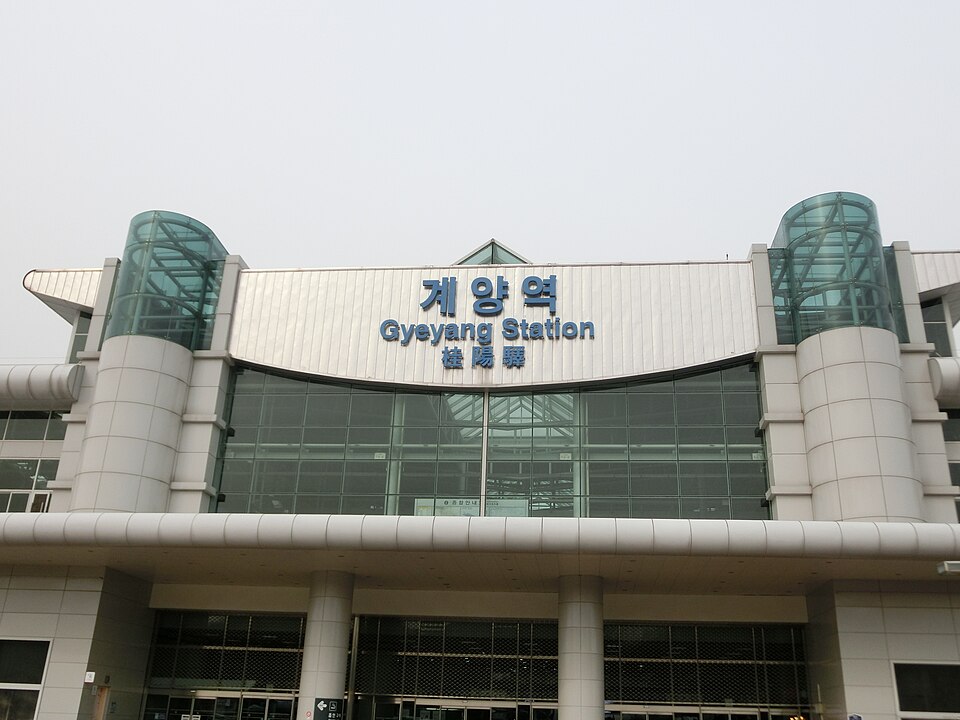
Functionally a transfer station, but Gyeyang Mountain sits nearby and offers a straightforward hike with a view over the airport approach and the Han River estuary. It is not a famous mountain and you will mostly encounter local retirees on the trail, which is rather the point.
Ara (아라)
Named for the Gyeongin Ara Waterway, the canal linking the Han River to the Yellow Sea. There are cycle paths along its full length and several viewpoints. Our Ara Waterway guide covers the route in detail.
Worth noting: this station immediately became one of the busiest on the entire line after opening — busier on a daily basis than several of the major transfer stations. That tells you something about how underserved this part of the city was.
Geomdan Hosupark (검단호수공원)
The northern terminus, serving a new town still under construction. There is a lake park and not much else yet. Included here for completeness rather than recommendation — though if you are interested in how Korean new towns are built, watching one mid-assembly is oddly compelling.
Practical Notes
Buy a transit card, not single tickets. Single-journey tickets require a deposit you have to reclaim from a machine, and the machines are not always where you expect. A T-money card costs a few thousand won at any convenience store and works nationwide.
Announcements are in four languages — Korean, English, Chinese, and Japanese — but only for major stations. Minor stops get Korean and English only. Station numbers are displayed everywhere and are the most reliable thing to navigate by.
Every station has a lift. Follow the yellow tactile paving. This is consistent across the whole line, unlike some older Seoul stations.
Rush hour runs roughly 07:30–09:00 and 18:00–19:30, and the Bupyeong-to-Gyeyang stretch is the tightest. If you have luggage, avoid it.
Toilets are inside the paid area at most stations, which is convenient but means you need to have tapped in.
A Line Worth Riding
Incheon Line 1 is not a scenic railway. It is almost entirely underground and the trains are ordinary. But it connects a genuinely unusual range of places for a single metro line — a reclaimed international district, a century-old port city’s commercial core, preserved wetland, and a new town that did not exist five years ago.
If you have a spare day in Incheon rather than a spare hour, ride it end to end and get off somewhere that sounds interesting. The city rewards that more than its reputation suggests.
More places along the line are collected in our Hidden Korea section.
Dongincheon is the stop for Sinpo International Market, and the underground arcade runs from the station gates all the way to the market entrance.
Incheon Station is the western terminus of the line, and the gate to Incheon Chinatown stands directly across the road from Exit 1 — one of the few places in the country where a major sight is thirty seconds from the turnstiles.
Two stops before the Incheon terminus, Dongincheon Station sits at the center of the old treaty port district — and an underground arcade runs from the platform level all the way to Sinpo Market.
Ride to the end of the line and you’re at Incheon Station — the gateway to Wolmido and its amusement strip.